The chance to do two walks in a weekend could not be missed and the weather looked perfect for it, a nice crisp clear morning and an 08:30 pickup meant we had a great view of the dawn! There are loads of pictures to follow, just because it was such a stunning day

The target was Meall Dearg which is just west of the road from Amulree to Aberfeldy. SOTA GM/SS076, WAB NN84 and Trig point TP0671.

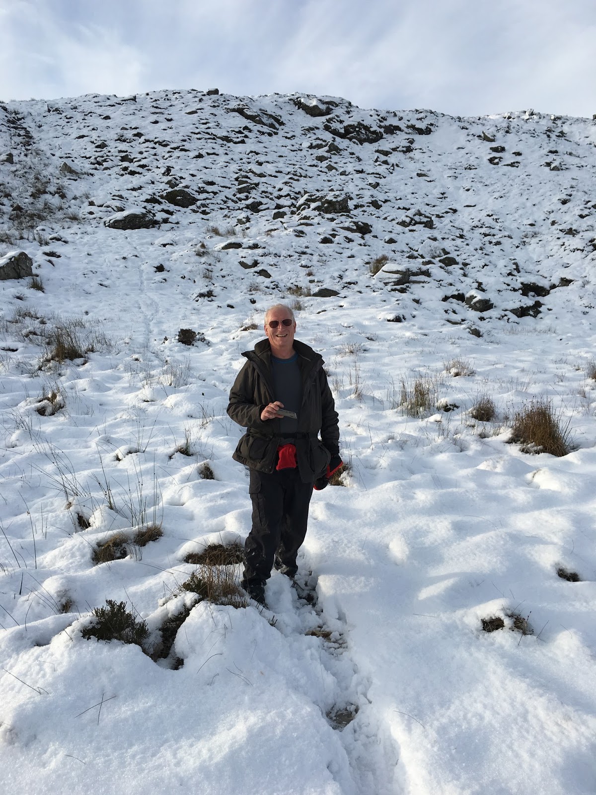
As we parked up just short of the bridge across the Cochill Burn, the weather was just a wee bit parky

The hill looked quite snowy from the roadside but the plan was to zig zag straight up the direct route behind me

this very rapidly proved to be a very bad idea. There is nothing worse than a bog with deep heather all covered up with snow, so we backtracked and headed down the road to pick up General Wades military road (https://en.wikipedia.org/wiki/Old_military_roads_of_Scotland).

It was pretty frosty!


With ice hanging down into the streams

and nice contours on frozen pools

But even so, felt pleasant enough in the wintery sunshine for me to shed my fleece, hat and gloves!

In no small part due to the absolutely windless day, evidenced by the completely stationary turbines over the valley, not something we experience often!

All too soon though, we found the old road reaching its highest point and dipping downwards again. No chance were we losing height, time to head upwards cross country, this proved to be a bit of a mistake! As you can see in the following sequence, the depth of snow increased rapidly with increasing altitude, much more so than it looked from below!


This coupled with the increasingly rough and rocky terrain made life very difficult, it may be safe to follow this route when it's clear but there's a huge danger of putting your leg in a hole. What we did find is that the rabbits and hares had also had this problem, but were in fact quite good at route finding, there had been so many that they'd made a trail for us


We realised that this was going to be a slow job when we crested a false summit to see the real one

Was this even doable? Thankfully, before too much further we came across an unmapped track that traversed the hill, it climbed heading south and we took it. There was no way we could head any further going straight up to the summit!

That didn't mean it was easy though

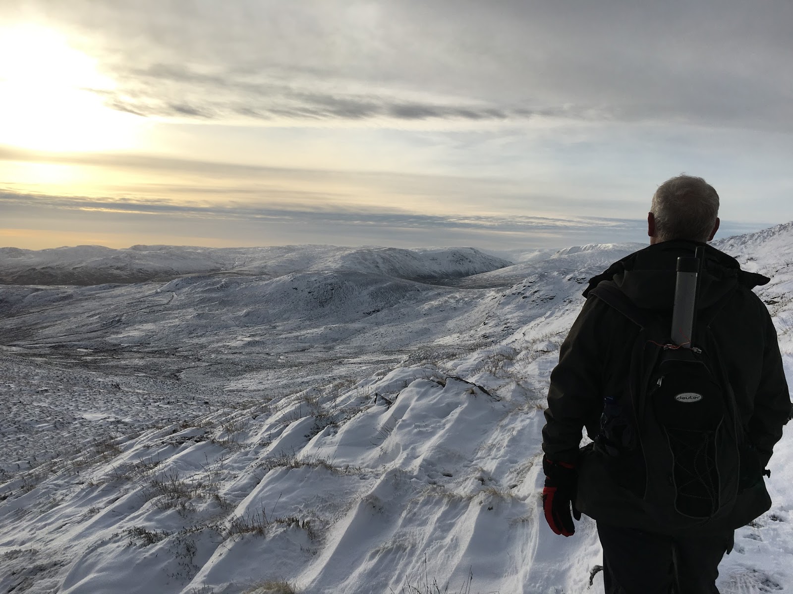
and the scenery became increasingly bleak

Eventually for the second time this walk we crested a rise on a track to see it descending as it went on. Now was the moment of truth. We stopped and had a debate "was it even physically possible for us to battle across this wasteland, and get to the summit"? The camera flattens the hill, the reality was far more daunting

Thankfully we spotted that someone had been here before us (no sign now, wolves got em?) but it meant we had some foot prints to put ours in and more to the point, saw where not to step (drifts that went past knee level). As we approached the final bit, the going got a bit easier, and the views got even more stunning


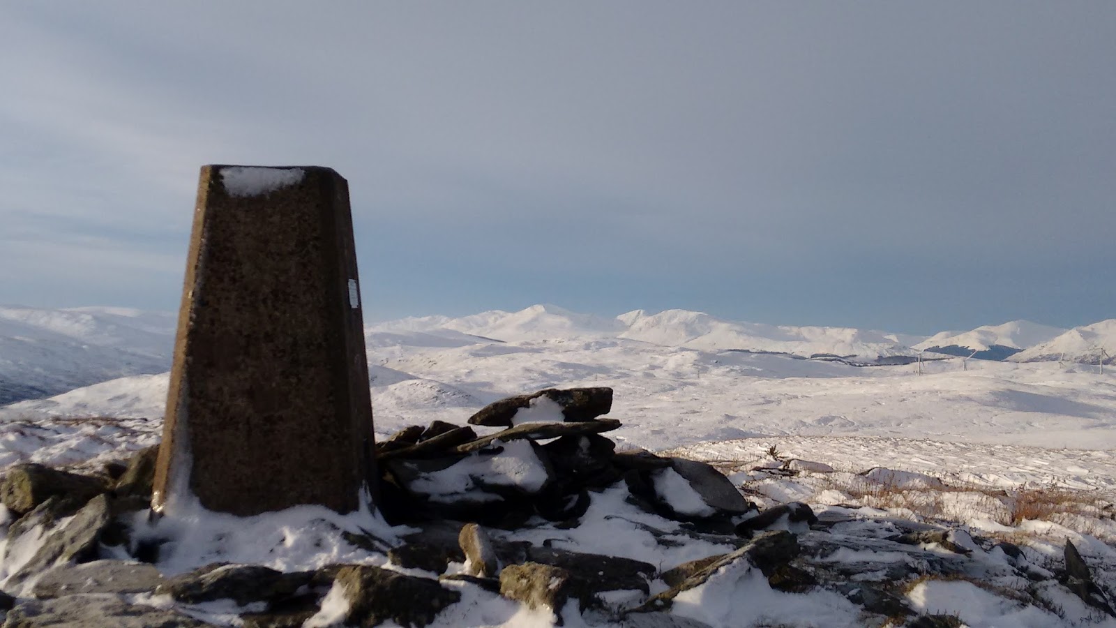
Then it was the next decision point. Was it possible to get up there, we spent a few minutes planning a route, the camera flattens it, you can see the trig on top.

Yes, we could see a safe way up, and happily no one died.


This was a welcome sight!

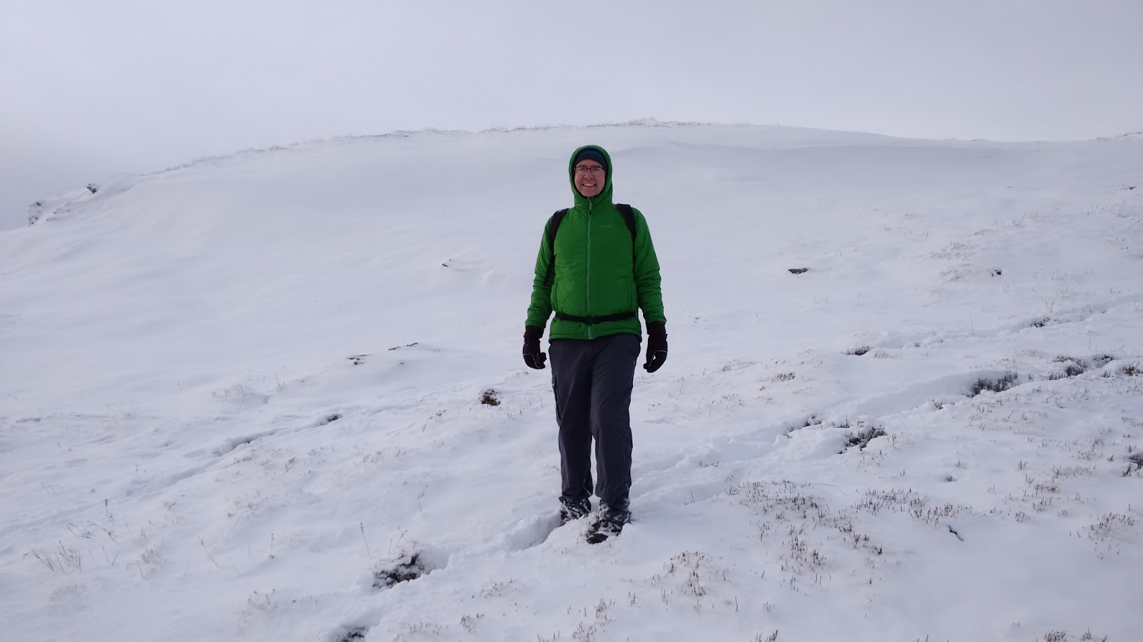
And so, we got the radio setup. The fleece, hat and gloves went back on PDQ!

How did the radio go? A difficult start, I normally check all is well before committing myself, but this time just dived into the WAB net on 7161, things were clearly wrong, people weren't hearing me well, less than 2 watts out with a high SWR. I called for a halt and brought the aerial back down, nothing wrong.. puzzled.. It seemed that the SWR went down as I tuned higher up the band so I extended one leg of the dipole about 9 inches. The SWR came down to a level where the radio would give 4 watts, I've no idea why the antenna went resonant very HF of 40m, maybe something to do with the hump on the summit and the snow? It had been fine the day before also over snow covered ground. Anyway, back to the fray with more success, curse the lost time, but I eventually managed 13 WABers in their very disciplined net, thanks guys!. A QSY down to 7093 and a spot on both sotawatch and the new WAB chat (it was cold and I was now in a hurry) brought EA2CKX as the first qso, how does Pedro manage to be there on 40m so regularly when you wouldnt expect propagation? Then followed 13 others in 8 minutes including regular, Mick, M0MDA, Mike, 2E0YYY (is that the first?) and Robert SP8RHP for another surprise one at that time of day. Time was running on and temperature, running out, a quick qsy to 20m brought 13 qsos in just 5 minutes including regulars DL3HXX, OK1SDE, and HB9AGH, plus SP8RHP again for 2 band slots, finishing off with an S2S with DL/HB9DQM/P on DM/BW176. By this time we were hitting 45 minutes operating and I was getting very unpleasantly cold. The sun seemed to have gone and it was time for a rapid exit. We stripped everything down with me jumping around as much as possible to try and get some warmth back.

To get down, there was no way we were trying the route we'd come up, it was far too steep, we took the more easterly side of the summit where there was deeper snow but a shallower track.
(not that shallow!)

The deep snow was easier going down than it would have been going up even if we did occasionally sink in below knee level

There were some very tricky patches

and some stunning views


We were please to get on the track again, but decided the route we'd used to get up would be deadly in these conditions to descend on, so we just continued on the track all the way north until it met up with General Wades road, just at the forest.


We seemed not to be the only users of the track, it looked as though it had been a rabbit/hare motorway, with two sets of tracks one on either side , I wonder whether rabbits are left or right hand drive?


And so for the best pint ever!

It was supposed to be a nice easy walk, but ended up at 11.5 kms and 360m ascent in some of the most difficult walking conditions. Brilliant!
No comments:
Post a Comment